Display Lists of Blocks


The Block Numbers are from late 19th Century fire insurance maps
such at the one one the right.

Map Source: Washington University Digital Gateway
Historic St. Louis Maps
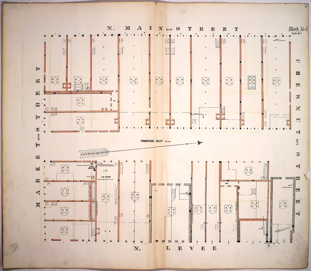

The Block List Format:
     X_Y_A_P.... where X , Y, A, P etc. are any valid Block Numbers. For example, 8_60_983

                          Blocks:


to be viewed in GoogleEarth Pro.            


Riverfront
6_7_8_9_10_32_33_34_35_59_60_61_84_86_101

Scott Joplin Neighborhood:
931_932_525_936_926_922_983_982_111_1712

Old North Redevelopment:
1116_1117_1118_1119_1122_1123_1124_1125

Lucas Place:
512_513_826_827

Henry Shaw's Block:
181

Harlem Creek:
4359_4360_4364_4518_4519_4519B_4520_4520B_4822_4823_5246_5930_5931_5239_5247_5248S_5249_5282_5932_6132


A link to a .kmz localization prototype that:
  1. Includes textures in the .kmz rather than requesting them.
  2. Computes and includes in the .kmz, an initial LookAt

Cesium View Notes

The Date Range:
     The default date range is 1830-2000 and the current date is set to 1930 so it moving the time slider may be necessary to see buildings on particular blocks.

The View:
    The pitch and angle of view are fixed, but the distance is calculated so as to show all chosen Blocks. Thus a List of Blocks geographically separated might display very small building models.